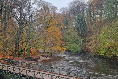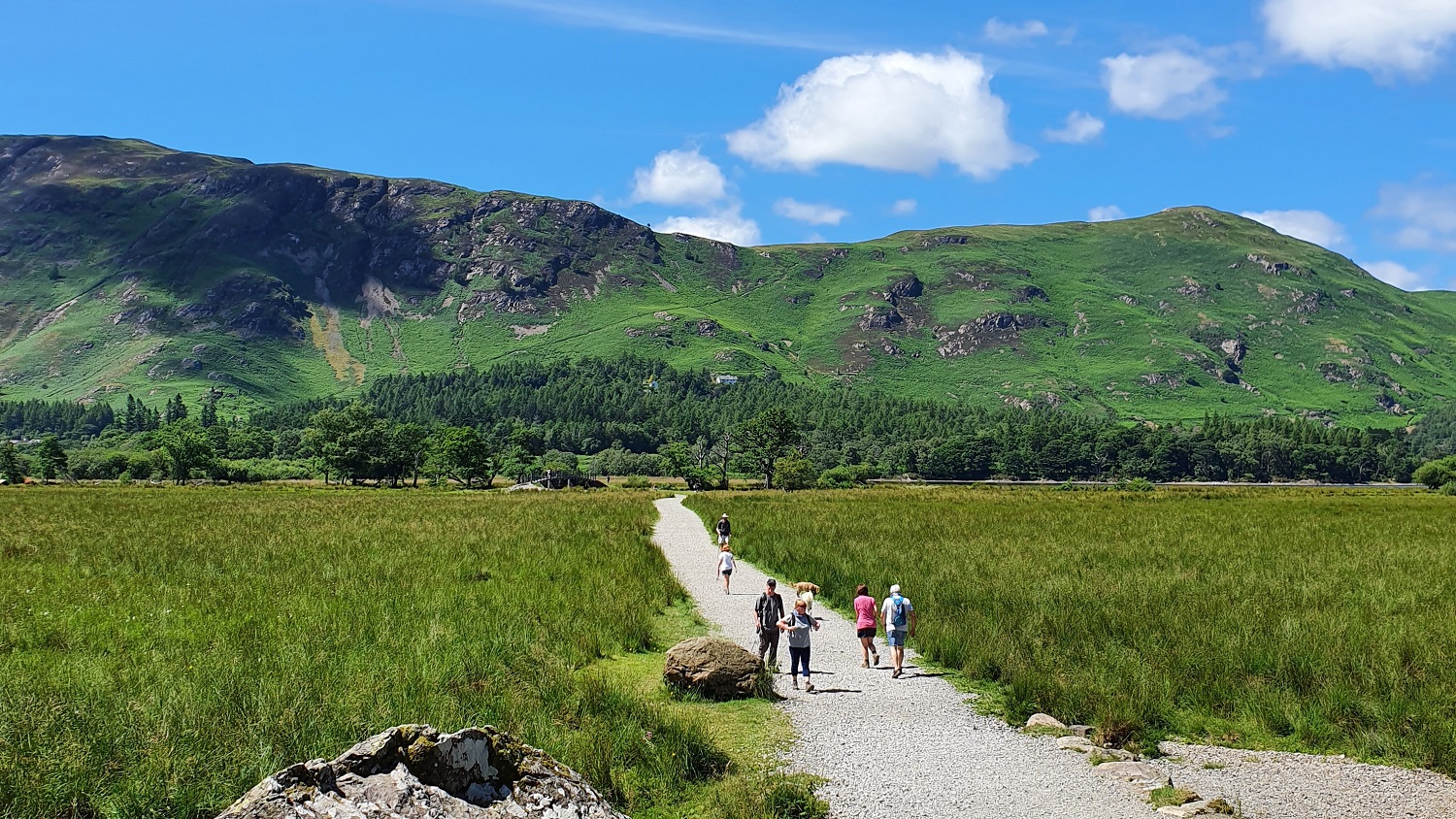
Monks Bridge is the perfect base for a walking holiday, being located within the Yorkshire Dales National Park and within easy reach of the Lake District and the Pennines. There are also some beautiful walks straight from the door. There are routes for all abilities from serious fell climbs to gentle strolls and we have put just a few of our favourites here to start you off.
Summer evening stroll before dinner
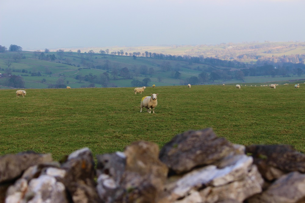
We love to walk up the hill and enjoy the beautiful view across the village to the Lake District beyond as the sun starts to go down. Turn right out of the cottage, cross over the bridge and walk up Bank Head following it round into Bank Lane. You can go as far along the lane as you like. There is a bench at the top of the hill where you can sit and enjoy the view. If you look over the wall behind you there is a good view of the Pennines too. If you carry on further up the field to the top, you get a 360 panorama of the Pennines and the Lake District and everything in between. For a short evening stroll you can come back down the lane and take the path off to the left to cross over the river to Silver Street. We quite often do this walk on our way to The Butchers Arms for dinner!
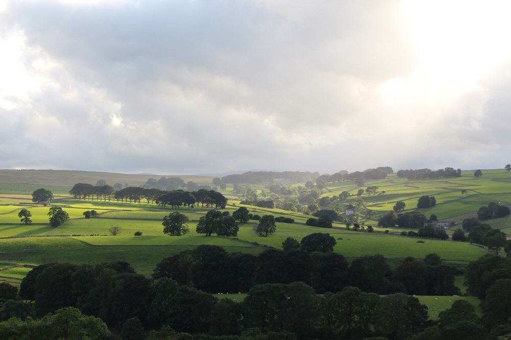
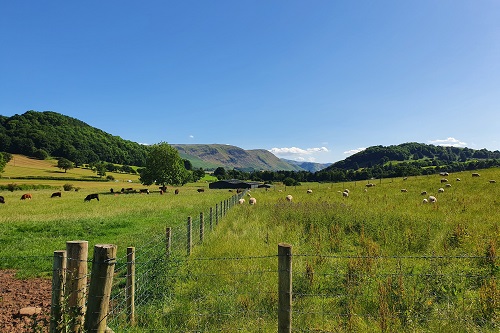
Looking across to the Lake District in the distance
A Short Walk Along the River to Maulds Meaburn
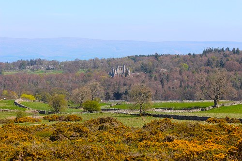
If you cross over the bridge next to the cottage and take the footpath between the river and the farmhouse you can wander along the river and through the fields to Maulds Meaburn. As you approach Maulds Meaburn village you will pass through a stone arch along the path with Flass House on your left. Flass is a Palladian-style villa with a colourful history which was rebuilt in the mid-19th century by the Dent family. Owned by them until the 1970s it has sadly fallen into disrepair but has recently been sold again so let’s hope the new owners can restore it to its former glory.
Pass Flass and walk into the village and say hello to the sheep on the village green. You can then cross over one of the bridges and walk along the lane back to Crosby. Sometimes they do coffee and cake at the Maulds Meaburn Village Institute if you fancy a break.
If you would like a more taxing walk to Maulds Meaburn you can walk up Bank Head and follow the paths across the hills and back round to Maulds Meaburn by Brackenslack Farm. This leaflet is good for more detailed information on these local walks.
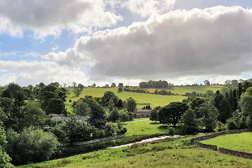
Crosby Ravensworth Fell
A good walk exploring the local fell taking in a stone circle, Coronation tree and the source of the Lyvennet if you desire. There are lovely views too across to the Lake District, the Pennines and the Howgills. Make sure you time it so that you can finish up with refreshments at The Butchers Arms when you come back through the village. Again, the leaflet mentioned above has all the details.
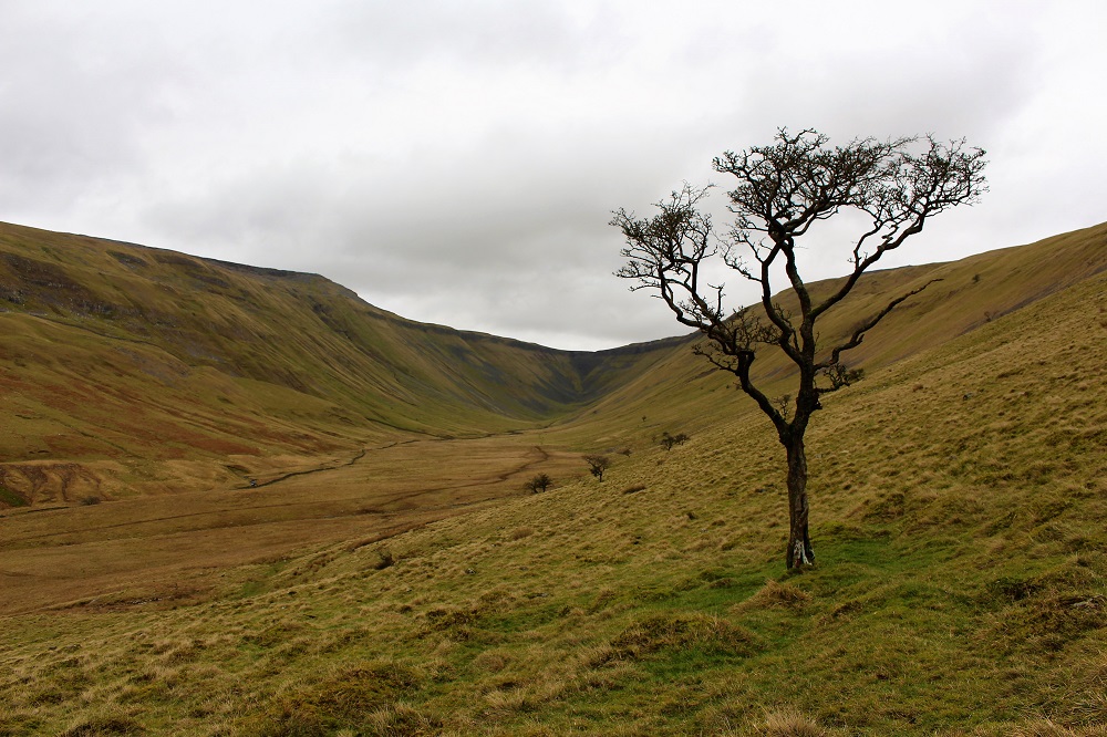
High Cup Nick
High Cup Nick is a spectacular U-shaped glacial valley carved out of the Cumbrian side of the Pennines. You can see it in the distance as you emerge from the trees on the drive towards Appleby on the B6260. There are various routes you can take. When we did it I had a bad back so we parked at the side of the road by High Cup House and walked up past Harbour Flatt, taking the low path to the bottom of the valley. Next time we will take the high route from Dufton to get the spectacular views from the head of the valley. This website is excellent for this and other walks in the area.
Ullswater & Aira Force
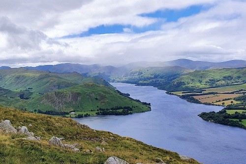
There are numerous options for walks around beautiful Ullswater, described as “that loveliest of lakes” by Alfred Wainwright. The Ullswater Way now has loops which incorporate Lowther Castle and Dalemain Mansion as well. We like to drive to Pooley Bridge at the north end of Ullswater, about half an hour from Monks Bridge. You can park here and catch the Ullswater steamer for a pleasant boat ride down the lake to one of the stop-offs and then walk back to Pooley Bridge, taking in the stunning scenery. We have walked Howtown back along the lake side to Pooley Bridge which was an easy walk. Another more challenging option is to take the higher route towards Howtown and then walk back along the lake shore. The views from the fells are beautiful in all directions and well worth the climb! There are numerous opportunities for refreshments in Pooley Bridge.
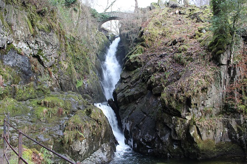
Further round the lake the steamer also stops at Aira Force or you can equally easily drive there if you prefer. It is just over 40 minutes from Monks Bridge. When we went it was the week I had my bad back so we literally just walked up to the waterfall from the lakeside car park. There are other car parks and various walks taking in the surrounding fells as well as the Force.
The Dalemain Loop
The Dalemain Loop is a relatively new loop that has been added to the Ullswater Way. At about 8.5km it took us just under two hours but add on to that time to explore the gardens at Dalemain, enjoy refreshments from their tea room and of course, pick up a jar or two of award-winning marmalade from their shop! We started the loop at Pooley Bridge with a pleasant walk along the banks of the River Eamont to the lovely Dalemain Mansion. On leaving the mansion you follow the track to Dacre, passing the small but impressive 14th-century castle which is now an intriguing residence. The path takes you through the village and then back down towards the Eamont, skirting around Soulby Fell on the way. There is a nice looking pub just up the hill in Dacre. Will have to try that next time! It’s a good walk if you haven’t got all day. There are gentle climbs and, of course, beautiful views! If you park at Pooley Bridge you have the added bonus of being able to pop into Chestnut House at the end for vital (gin) supplies!
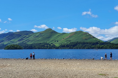
Cat Bells, Derwentwater
Derwentwater is a beautiful lake with various islands and stunning scenery all around. Mind you, I think this applies to most of the Lake District! We drove to Keswick, about 45 minutes from Monks Bridge, and caught the Keswick Launch to Hawes End where you can follow the signs to Cat Bells. The path up is obvious and can be quite steep with a bit of a scramble in places. It is a popular walk so can get busy. The views at the top are absolutely beautiful in all directions and well worth the climb. The path continues south from the summit and as you descend you can head left, back towards the lake where you can catch the launch at High Brandelhow after a cooling paddle in the lake! There are other landings not far away if you want to extend your walk further.
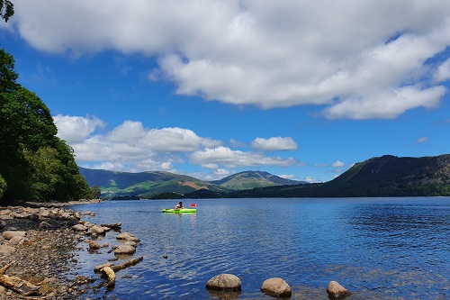
Around Derwentwater
If you are looking for a good hike but without big climbs then this is an ideal walk of about 16km. We took just under 5 hours overall but that included about 1.5 hours of drink, lunch and paddling stops! Derwentwater provides bucket loads of stunning scenery and the walk covers a variety of terrain from lakeside gravel paths to ancient woodlands and marshland boardwalks. We won’t describe the whole route here as it is well documented and various downloadable maps are available. We parked at the Lakeside Car Park in Keswick and set off past the Keswick Launch. Friars Crag is a well-known viewpoint early on in the walk and one of many photo opportunities for that iconic Lakeland view. As well as glorious scenery, look out for the sculptures of the Hundred Year Stone and the giant hands known as Entrust.
We took a packed lunch which we enjoyed in a shady spot on the western shore before a paddle to soothe our hot feet! There are various places along the way for refreshments but the only one we can comment on for the moment is the lovely Lingholm Kitchen. The café with its large terrace has a glorious view over the impressive walled kitchen garden and beyond to Skiddaw in the distance. A welcome, pretty stop in the latter stages of the walk.
Of course, if you run out of steam on this walk there are various points around the lake where you can catch the launch back to Keswick but we would highly recommend completing the circuit if you can.
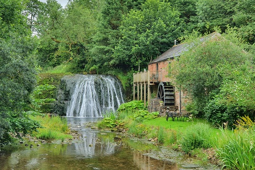
Appleby to Rutter Falls
This is a lovely circular walk which takes you from Appleby, alongside the River Eden towards Great Ormside, across to Rutter Falls with its impressive waterfall and pretty mill and back to Appleby via Hoff and along Hoff Beck. It is a lower level walk with pretty riverside views and the opportunity to pop into the New Inn at Hoff for refreshment along the way!
Somehow we managed to miss out Great Ormside but will visit another time. Rutter Falls is a lovely place to linger, watch the birds feeding in the river and enjoy the view of the mesmerising falls. After a pause here you follow the route to Hoff and back along Hoff Beck to Appleby. The route takes you along pretty river banks, through woodland and across green pastures and meadows with an abundance of wildflowers so there is plenty to see without the big climbs!
The Lowther Loop
The official Lowther Loop is another addition to the Ullswater Way, taking in Askham Fell, Askham village, Lowther Castle and the River Lowther. We started from Lowther Castle and completed a circuit of just over 12.5km. It is a fairly easy walk with some gentle climbs, the steepest of which was probably the climb back up the Lowther escarpment at the end! If you wanted to avoid this you could always start and end in Askham itself.
From Lowther Castle, you head west across the front of the castle and follow the path down to and along the river, following the bend right onto the lane. A short distance along the lane take the path to the right across the river and onto the pretty village of Helton. Walk into the centre of the village and then back on yourself for the gradual climb up to Askham Fell, following the sign from the road. There are beautiful views across to the Lowther escarpment and fells to the south and then over to the Helvellyn range in the west. If you carry on a little further towards Pooley Bridge or Howtown, Ullswater will come into view but we followed the signs back to Askham across Askham Fell. There were some gentle fell ponies to say hello to and then views of Lowther as you begin to walk down into the village. We enjoyed a refreshing pint at The Punchbowl Inn before the steep climb up the escarpment back to Lowther Castle.
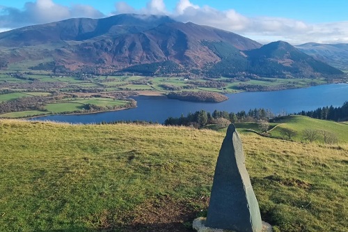
Beacon Hill Monument
Beacon Hill Monument was erected by local sculptor John Bland to commemorate Queen Victoria’s golden jubilee in 1887. We took it in on a short loop, stretching our legs after the long drive up from Kent, but there are several options for longer walks either directly from Monks Bridge or loops to take in more of Orton and Great Asby Scars.
Our easy option meant we drove south out of Crosby Ravensworth on Gilts Lane towards Orton. At the B6260 turn left and then there is a small car park about half a mile along on the right. Follow the path south to the monument. It is just a gentle climb but the ground is quite uneven and rocky, not surprisingly! The panoramic views from the monument are quite spectacular, taking in the Howgills, the Pennines and of course the Lakeland Fells. We looped back to the car via the old quarry to the east but will certainly explore further afield next time.
Sale Fell – Rivings Loop
This is a shortish walk, lasting only a couple of hours, but with some spectacular views and a very nice pub at the end! We parked at the side of the minor road just off the A66 which leads to The Pheasant Inn. There is a bit of walking up the lane but hardly any cars pass by. The climb up the fell is fairly steep on a mix of gravel and grass paths but the 360 degree views at the top are so worth it! You can see as far as the coast in the west and beautiful Lakeland Fells almost around. Once you have reached the summit of Sale Fell you head east along the top path to Rivings and then Lothwaite. Here, the views over Bassenthwaite Lake, Skiddaw and Blencathra beyond are quite breathtaking!
We could have enjoyed a long picnic here but then the temperature reminded us it was November, despite the glorious sunshine! So we made our way off the fell and weaved our way through the forest on the easy gravel tracks. The Pheasant Inn was very welcoming for a refreshing pint before heading home.
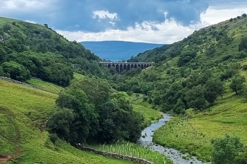
Smardale Gill & Smardale Viaduct
There are a number of viaducts close to Monks Bridge which add points of interest and some spectacular views on walks. The loop we took to the Smardale Viaduct started in Ravenstonedale and was about 7.75km. We parked in the little triangular car park by the school then walked down through the churchyard and over the village playing field to pop out beside the King’s Head pub. From here you cross over the main road and then walk down Mill Street to the path which takes you alongside Scandal Beck with the farm to your left. A short way along you re-join the farm track and this takes you slightly away from the beck then the path leads you across the fields. You’ll get to a dry stone wall with a bridge over Scandal Beck to your right. At this point, rather than crossing the bridge, continue ahead and slightly left up to the old railway line path which is then easy to follow, past the old lime kilns, to the viaduct. It is quite a structure! Cross over the viaduct and you can walk back along the other side of the gill, enjoying the views back to the viaduct as you go. We encountered a number of people doing a butterfly survey as Smardale Gill is one of only two sites in England where you can see the Scotch Argus butterfly!
The path takes you through fields and back to the beck so you eventually emerge conveniently close to the King’s Head for refreshment!
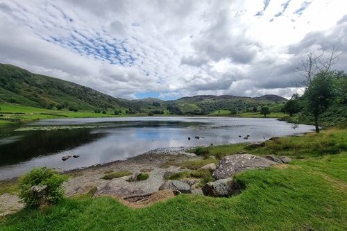
Rosthwaite to Watendlath
I used to stay in Watendlath as a small child so had been meaning to return for some time and it was lovely to go back. We couldn’t get into the Rosthwaite National Trust Car Park so parked in the much larger car park next to the Scafell Hotel just south of the village. You have to pay the hotel. Walk back up through the village, taking care on the road, then take the right turn up Hazel Bank Drive and the footpath over to Watendlath is signposted. The climb and descent is mainly on loose, rocky paths so I was fairly slow with my dodgy knees but the views across Borrowdale are absolutely stunning. Watendlath is a tiny hamlet cared for by the National Trust, situated on the edge of Watendlath Tarn. It is such a beautiful and peaceful place which brought back some very happy memories and is well worth a visit. We were delighted to find the tea shop open but you might want to check their opening times. We walked back the same way but you can head south round the tarn and loop back to Rosthwaite taking in Watendlath Fell and Dock Tarn. One for another day for us.
Rydal Water & Grasmere
This walk has the benefit of gorgeous Lakeland views over two lakes, a visit to a cave and, if you’re lucky, you get a fighter jet flypast! Mind you the latter applies to several areas in the Lakes and Eden Valley. There are various car parks but we parked in the White Moss Car Park at the north western end of Rydal Water. Rather than follow the road we took the path that follows the River Rothay. We crossed the river and took the shore path along the south western edge of Grasmere, enjoying the views of the lake. When the path takes you up to the road you can loop back to walk along Loughrigg Terrace towards Rydal Cave. We had lovely views over Grasmere although if you make the climb up Loughrigg Fell the scenery is even more spectacular. From the cave we carried on down to Rydal shore then followed the path back to the car park, stopping for a coffee at the welcome riverside hut.
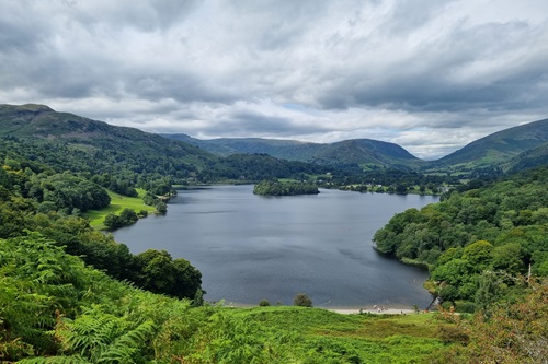
Buttermere
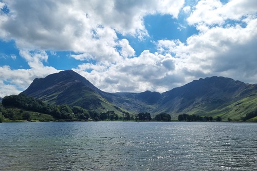
Beautiful Buttermere! One of our favourites. The approach road along the Newlands Valley is stunning and the views all around the lake are glorious. We parked in Buttermere and simply circumnavigated the lake but there are many more adventurous walks in the area, added to our endless list! The route we took was just over 8km and easy walking. On a hot day, the Lakes Ice Cream at Gatesgarth was very welcome and totally delicious! There are so many stunning photo opportunities all around the lake and plenty of places to stop and cool your feet if you fancy.
Lowther Estate, Askham Hall & River Lowther
There are many walking and cycling routes around the Lowther Estate so you have plenty of options and it is easy to park at the castle. On this autumn day, we chose a route of just over 8km which took us past Askham Hall & church then looped back round along the river and back to the castle café for lunch. Always a good plan!
We started by taking the path in front of the castle, heading north towards the river with the castle behind you. It is an easy path down to the river where we chose to cross and take the steeper climb up into the woodland for the path to Askham. Take care along the edge before you move further away from the steep bank then take the path right across the farmland and then onto the track which takes you alongside Askham Hall. Turn left down the hill when you reach the road and walk down to the church where there is a path signposted at the bottom end of the church yard. Follow the path and signs uphill past the church yards and then onto the track alongside the large field on your left. At the “private” sign, cross the woodland on your right to the lane and follow this until you cross over the river. Shortly after crossing it, there is a path signposted on your left and this takes you back along the riverbank and up the track to the castle…for lunch!
